Thomas Jefferson McMullan
Land Owned in 1846

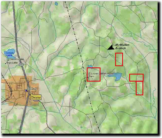
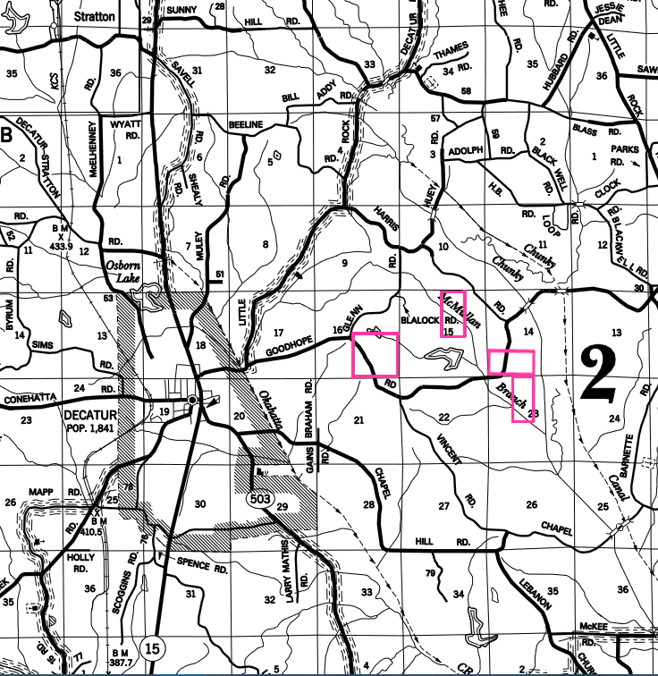
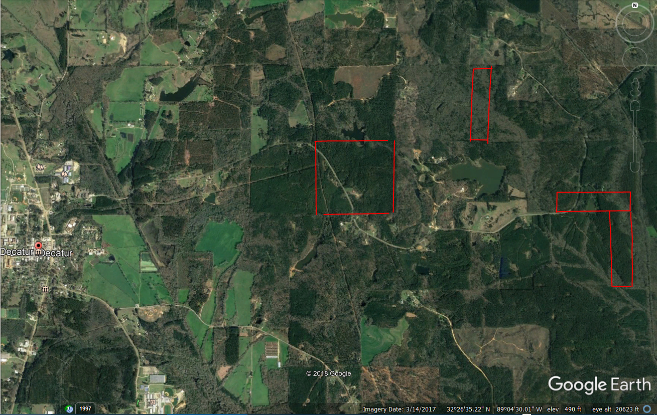
The following maps were put together from information provided by Mr. Melvin Tingle of Decatur, Ms. This is the land owned by Thomas J. McMullan in 1846.

Tom owned much more land but the Newton County, MS courthouse burned during Sherman's Meridian Campaign and a couple of other times where many land records were destroyed. This is all we have records for.

W 1/2 of NE 1/4 of Section 15
SE 1/4 of Section 16
S 1/2 of SW 1/4 of Section 14
E 1/2 of NW 1/4 of Section 23
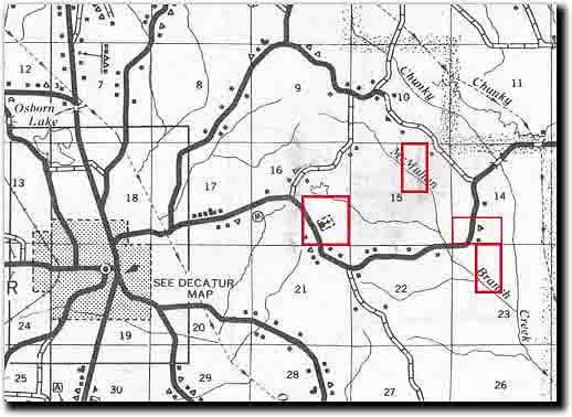

Township/Range/Section Map of Newton County, MS east of Decatur Showing Land Owned by Thomas Jefferson McMullan


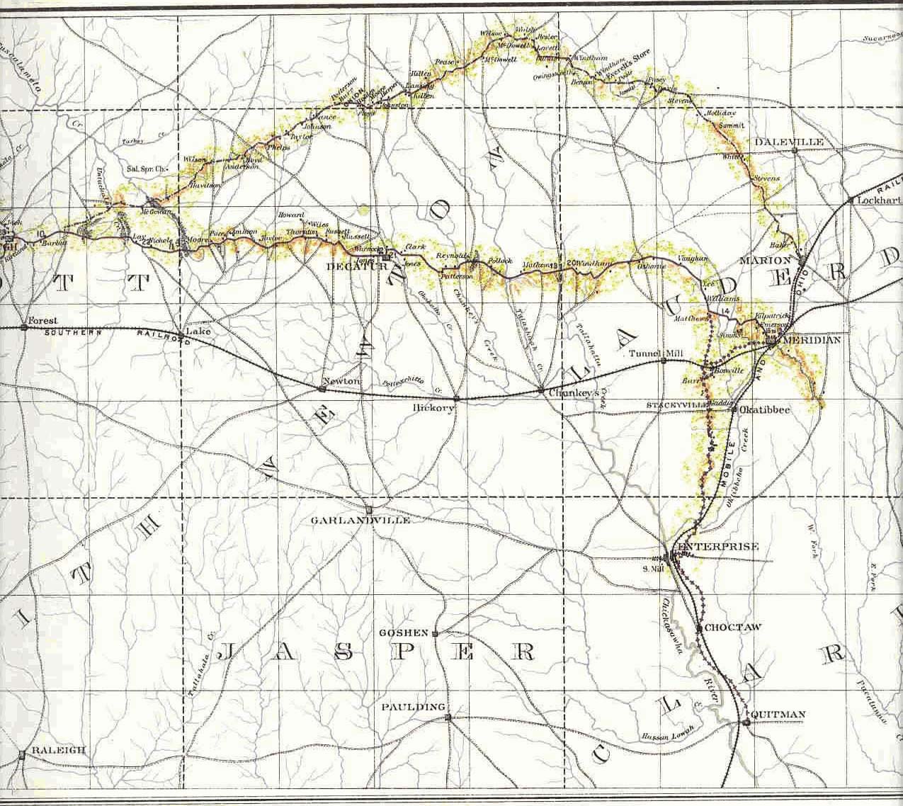
A Map from 1846 of General Sherman's March Across Mississippi in His Meridian Campaign.


A Modern Topographical Map of Newton County, MS Just East of Decatur, MS Showing Land Owned by Thomas Jefferson McMullan


A Modern Township/Range/Section Map of Newton County, MS east of Decatur, MS Showing the Land Owned by Thomas Jefferson McMullan in 1846.

A Google Earth Map of Newton County, MS Just East of Decatur, MS Showing Land Owned by Thomas Jefferson McMullan in 1846.
 

Click Here to Return to Thomas J. McMullan's Page


© 2002 - Present ALL RIGHTS RESERVED