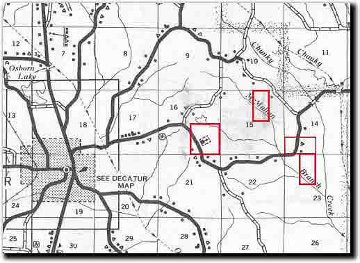
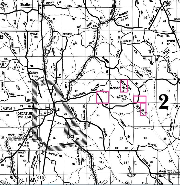
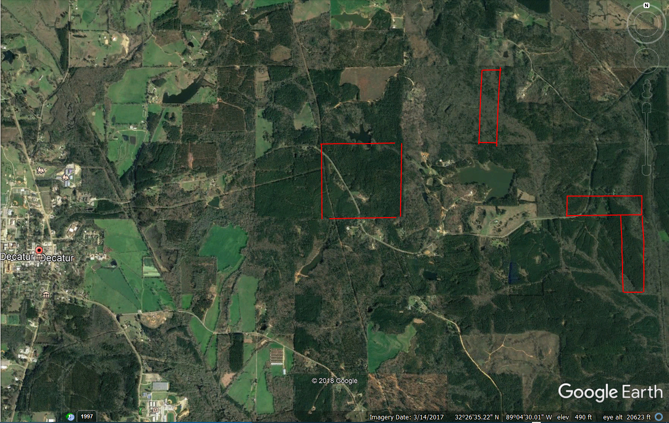
The
following maps were put together from information provided by
Mr. Melvin Tingle of Decatur, Ms. This is the land owned by Thomas
J. McMullan in 1846.
W 1/2 of NE
1/4 of Section 15
SE 1/4 of Section 16
S 1/2 of SW 1/4 of Section 14
E 1/2 of NW 1/4 of Section 23
Township/Range/Section Map of Newton County, MS east of Decatur Showing Land Owned by Thomas Jefferson McMullan
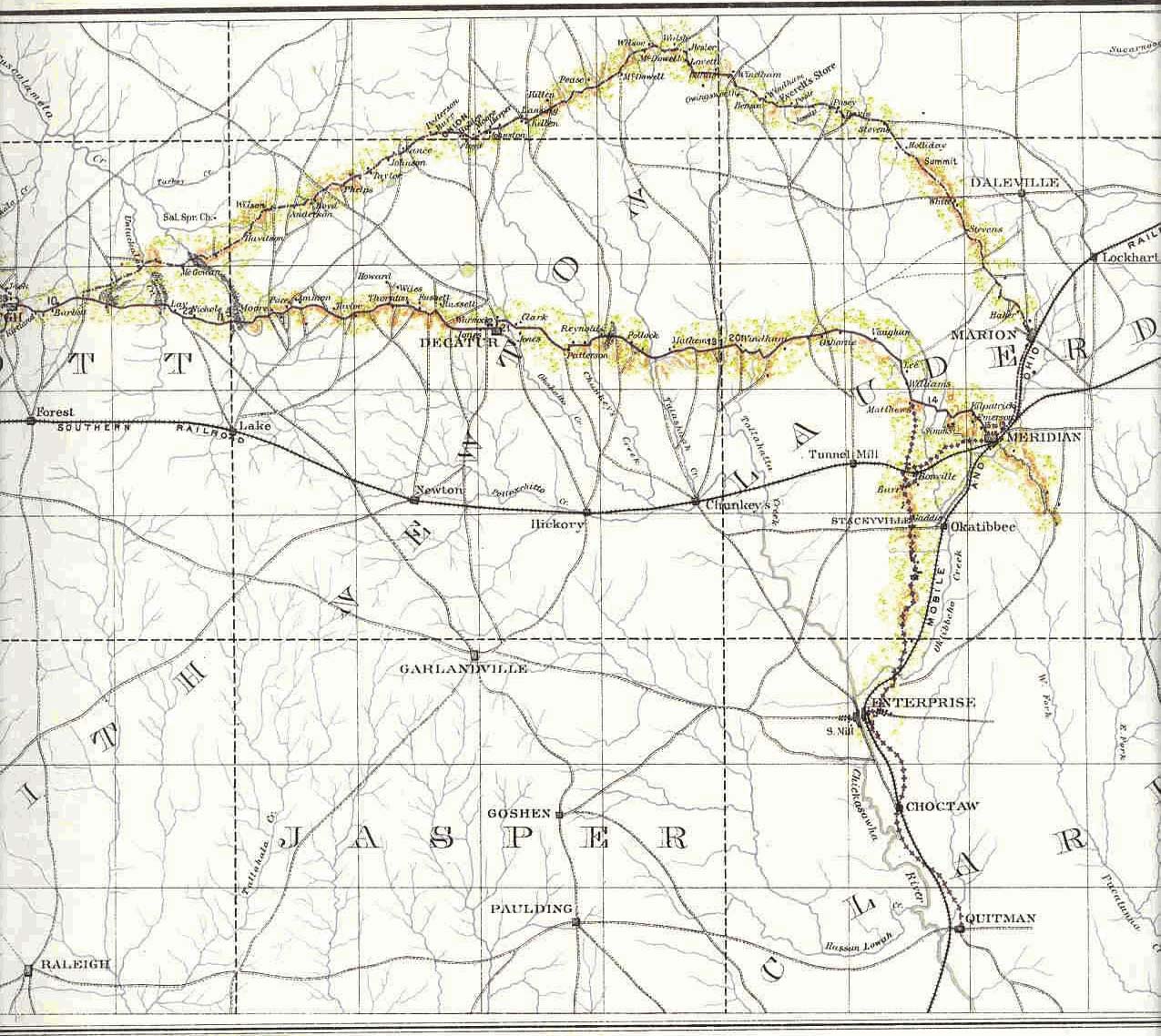
A Map from 1846 of General Sherman's March Across Mississippi in His Meridian Campaign.
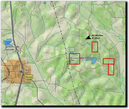
A Modern Topographical Map of Newton County, MS Just East of Decatur, MS Showing Land Owned by Thomas Jefferson McMullan
A Modern Township/Range/Section Map of Newton County, MS east of Decatur, MS Showing the Land Owned by Thomas Jefferson McMullan in 1846.
A Google Earth Map of Newton County, MS Just East of Decatur, MS Showing Land Owned by Thomas Jefferson McMullan in 1846.